Build Your Dream Project With Us
Vision Got Larger With Mission
Surveying solutions include a range of technology and services, such as using high-tech instruments like total stations and GPS for precise measurements, and employing advanced techniques like airborne mapping and 3D laser scanning for detailed data capture. Other solutions involve software for managing and processing data, such as CAD systems with automatic point grouping and mobile apps for data collection.
Unlimited Surveying Solutions
Over the years of undefeated success
From roads to buildings, from bridges to industrial plants, and everything in between, surveying is a vital need in today’s modernised and globalised civilisation. Explore the technology to achieve the most accurate measurements and up-to-date data to shape and build a better world.
512+
Successfully Project Finished.
25+
Years of experience with proud
1120+
Revenue in 2017 investment
1520+
Colleagues & counting more daily
Where Technology Meets Innovation
Our Topmost Quality Solutions
Realistically, Medir Instruments Limited has limitless expertise that spans LiDAR and remote sensing, mapping and photogrammetry, applications and decision support systems, and technology implementation. We complement that with digital capabilities, including data analytics, machine learning, cloud computing, and mobility, underpinning innovative geospatial solutions.

Land Minning
A range of strategies, including in-situ mining for soluble minerals, using advanced software like GIS for planning and management, implementing sustainable practices like renewable energy, and employing advanced physical and chemical techniques for stabilization and reclamation of mined land.

Building Survey
As building surveyors, we complete detailed reports, known as building surveys. Within these, we identify defects and advise on repair, maintenance and restoration options. Projects can include existing buildings, buildings of architectural or historic importance and the development of new ones.

Material Supply
Survey material supply includes a wide range of equipment, from high-tech instruments like total stations, GNSS receivers, and 3D scanners to basic tools like tapes, plumb bobs, and leveling staffs. Essential accessory materials are also crucial, such as tripods, poles, and prisms, which provide stability and accuracy for measurements.

GNSS Technology
Our Geosystems team developed GNSS antennae with true tilt compensation and with integrated Visual Positioning, giving the ability to visually measure points that couldn’t be reached with the pole tip. All GNSS solutions come with the same Captivate user experience, high-quality support, service and training.

Project Monitoring
Start with simple, manual solutions, and scale up into more complex, automated monitoring solutions. Regardless of the environment or the object that requires monitoring, our Geosystems’ sensors, software and services collect, process and report deformations, allowing experts to make critical decisions to save lives and assets.
Custom Development
Our company offers a wide range of services that ensure the most efficient equipment use. Services range from HxGN SmartNet measurement corrections for GNSS, secure cloud data transfer services with GeoCloud Drive, support and maintenance through CCP’s, online learning and more.

Project Consultancy
May involve hiring external experts to provide specialized management and technical services for projects, covering the entire lifecycle from planning and design to execution and commissioning. These solutions offer benefits like expertise, cost-effectiveness, and improved project outcomes by outsourcing core tasks.

Architecture Planning
The process may involve a range of approaches, from architectural design for buildings to software solution architecture for IT systems. Solutions can include architectural consultancy, comprehensive design services, software tools, and project management to address specific needs, ensure sustainability, and align with business goals.
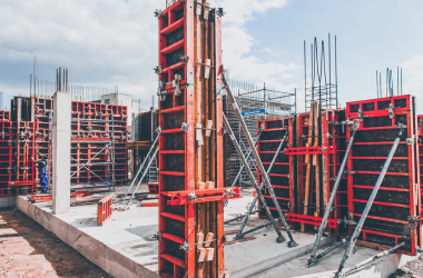
Crane Installation
A multi-step process that includes engineering and planning, site preparation, physical assembly and wiring, and thorough testing and commissioning. Key components of this process include detailed documentation, careful alignment of parts, electrical wiring, and safety measures like load tests to ensure the crane operates correctly and safely before handover.

Engineering Projects
Discover the surveying solutions that make field and office work easier and safer and complete construction and civil engineering projects in less time while reducing waste.
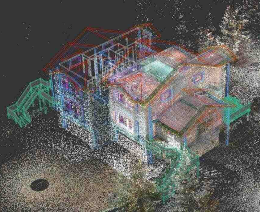
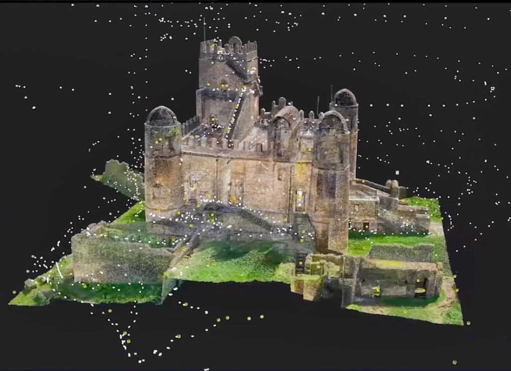
Scanning & Mapping
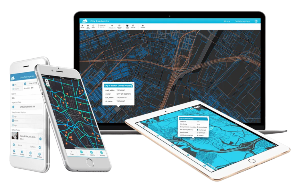
The concept of digitizing maps is a backbone activity for the GIS to generated online maps search as Google Earth and Google maps. With the evolving technology, geospatial choices are becoming numerous, especially the digitization of maps.
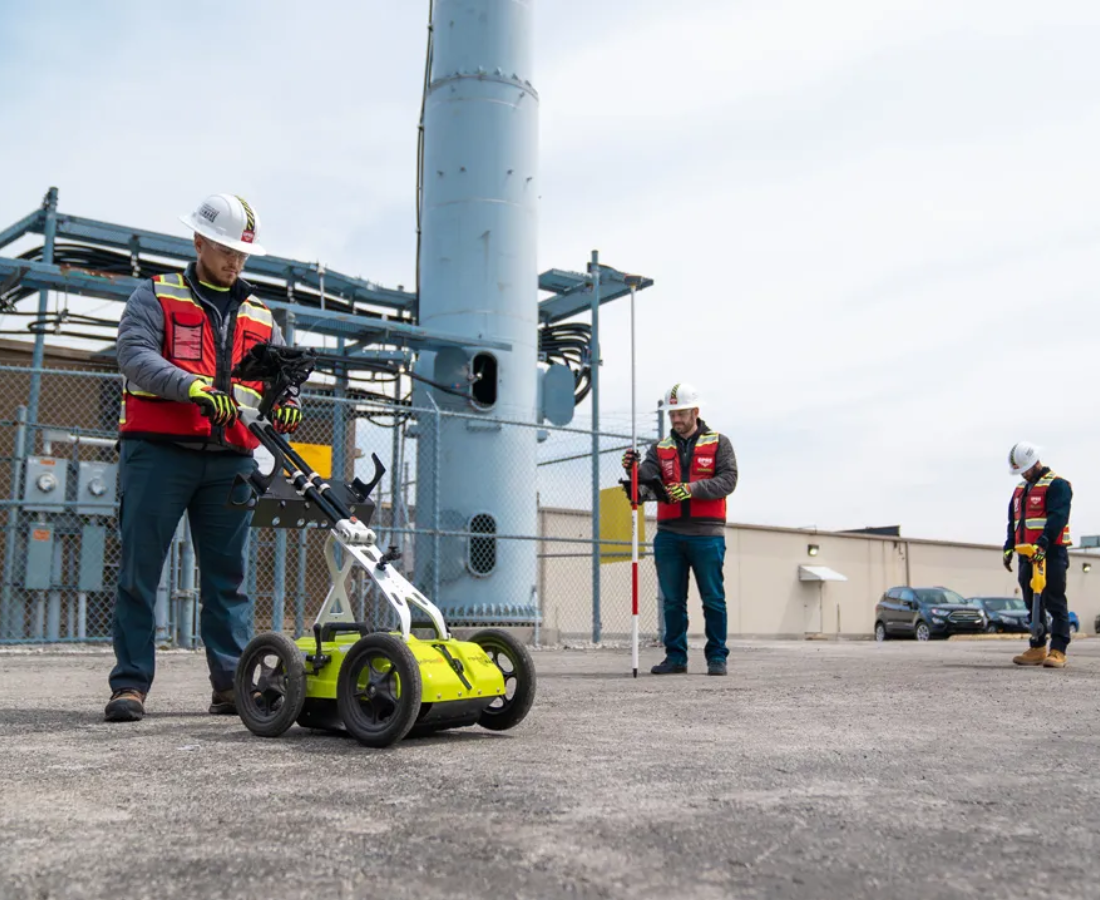
Utility Detection
Effortlessly navigate the underground, precisely locate and map utilities, minimise risks, and protect critical infrastructure during excavation. Take your surveying to new heights and revolutionise utility detection and mapping today.
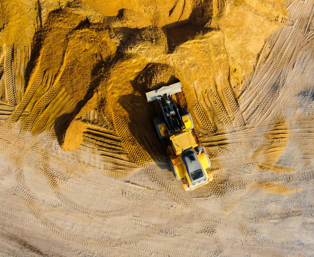
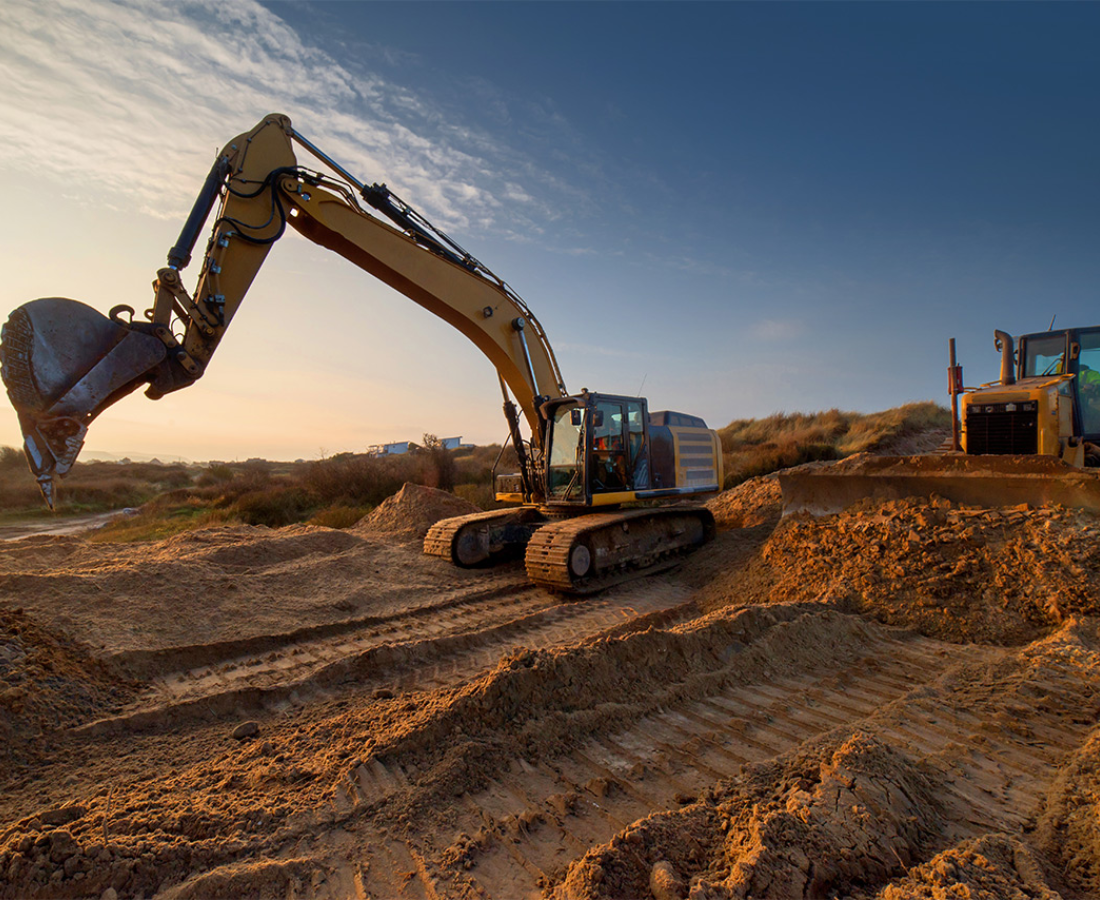
Land Excavation
A range of solutions and equipment to prepare land for construction, including site clearing (removing obstacles like trees and rocks), grading and levelling (creating a stable, level surface with proper drainage), and trenching (digging for utilities). Common solutions use equipment such as excavators, bulldozers, and skid loaders to perform tasks like foundation digging, erosion control, and material handling.
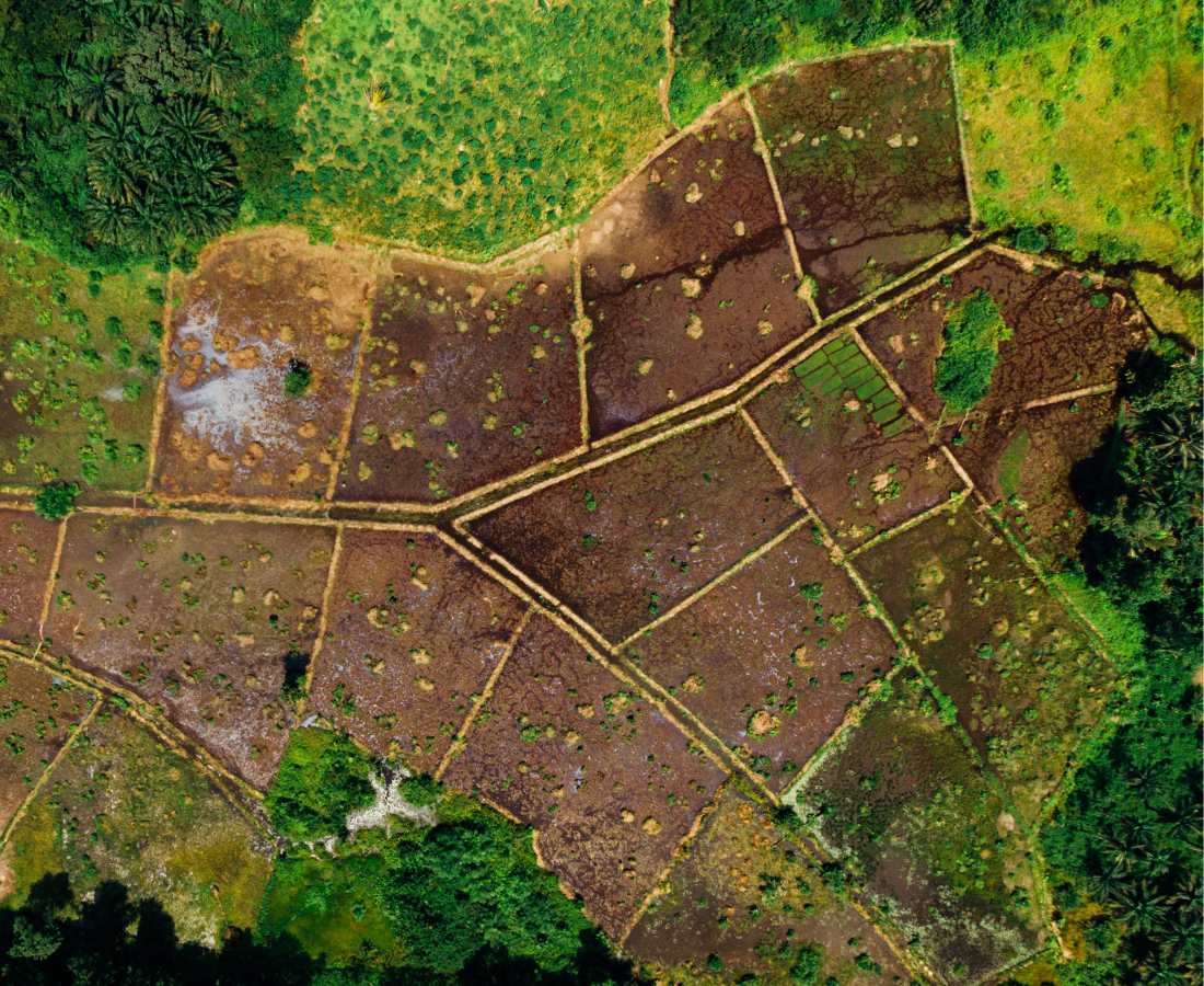
Land Filling
It includes waste reduction, pre-treatment, and improved landfill management to minimize environmental impact. Key solutions involve composting organic waste and implementing the 3 R’s (reduce, reuse, recycle) to decrease waste volume, while biogas capture, leachate management (e.g., using constructed wetlands), and using geosynthetics for containment improve landfill operations and safety.
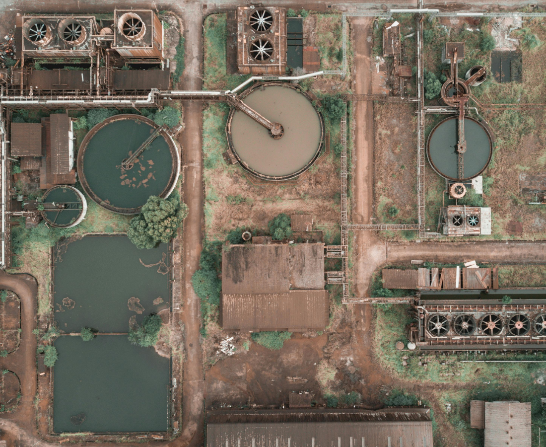
Sewage System
Centralized systems that collect waste and transport it to a municipal plant for treatment, to decentralized or on-site systems like septic tanks and smaller treatment plants for individual properties. Treatment methods include screening, sedimentation, and biological processes (using microorganisms) to remove solids and pollutants, and filtration and chemical treatment for further purification.
Helping Empower Sustainability
Driven by the best total station for every job
From the highest accuracy to standard accuracy, and from fully automated to manually operated, a total station is available for all applications. With a wide selection of total stations running Leica Captivate, it’s possible to deploy the best total station for the job without re-training personnel or changing workflows.
Get In Touch
3D Laser Scanning Solutions For Surveyors
Medir Instruments’ 3D laser scanning solutions open a competitive advantage for surveyors, allowing to capture any complex geometry with the highest productivity in any environment. Whether you are capturing, processing, extracting features or collaborating with your data, our complete workflow solutions fit the needs of any surveying project.
-
Sustainablility -
Project On Time -
Modern Technology -
Latest Designs
Simplicity Meets Efficiency
A Partner Helping Transform Communities Across the Globe
Bring your world into focus with on-demand access. Our SecureWatch subscription gives you on-demand access to the world’s most recent high-accuracy, high-resolution satellite imagery and analytics.
Empowering Partner
Discover how embracing digitalisation with technologies and processes can support your business to create new opportunities, stay competitive and improve productivity.
Growth Partner
Learn the skills to be more efficient and react to business opportunities. Unlock your potential to offer faster and more specialised services to your clients.
Consulting Partner
Regardless of how complex your task is, a solution is available within our diverse measuring, positioning and visualising portfolio to help you collaborate, be more efficient and succeed.
Geospatial Solutions Delivery
Since its inception, Medir Instruments Limited has been at the forefront of developing Geospatial Information Management Systems that respond to the needs of various clients. Some of our customers include Government Ministries, Departments and Agencies, development partners, and the private sector. Our rich expertise in spatial data capture, detailed spatial analysis, and spatial modeling using superior GIS solutions has been manifested in deliverables critical to decision-making in various essential areas.
On the one hand, our Spatial Solutions include equitable public service delivery in a devolved government system through service level mapping involving local communities, opinion leaders, and regional experts (including mapping of customer readiness to pay for improved services). On the other hand, we focus on Natural Resource Management, including land, water, and forestry resources. Next, we foster optimization of infrastructure and economic service delivery through detailed GIS databases, with key examples in energy, transport, water supply, ICT, and social infrastructure such as schools and health facilities, and retail industries.
Business Workforce Training
Medir Instruments Limited helps industry and government exploit the “power of location” in the digital age. From high-definition maps for autonomous vehicles to urban digital models that underpin intelligent cities to solutions that monitor and manage critical assets, we deliver the value of geospatial in meaningful new ways.
On that note, at Medir, we know that every organization has a unique group of individuals with various learning styles and training needs. Be that as it may, our training programs are designed to build and strengthen industry professionals’ managerial and technical skills through interactive programs. Therefore, we are pleased to invite you to our ongoing training workshops and bootcamps.
About Founders
Our Latest Works
Science Lab Building
New York, USA
Long Gate Bridge
Malmo, SE
Enix Lawyer Building
Toronto, CA
Deep Sea Bridge
Athens, GR
Whar Our Clients Say
Testimonials

Engineering Manager
Alice Howard
Lorem ipsum dolor sit amet, consectetur adipiscing elit. Ut elit tellus, luctus nec ullamcorper mattis, pulvinar dapibus leo.

Interior Designer
Nathan Marshall
Lorem ipsum dolor sit amet, consectetur adipiscing elit. Ut elit tellus, luctus nec ullamcorper mattis, pulvinar dapibus leo.

Architect
Ema Romero
Lorem ipsum dolor sit amet, consectetur adipiscing elit. Ut elit tellus, luctus nec ullamcorper mattis, pulvinar dapibus leo.

Manager
Ann Smith
Lorem ipsum dolor sit amet, consectetur adipiscing elit. Ut elit tellus, luctus nec ullamcorper mattis, pulvinar dapibus leo.
Request a Quote
Ready to Work Together? Build a project with us!
Learn More From
Frequently Asked Questions
1. How to create cities and communites that solve?
Lorem ipsum dolor sit amet, consectetur adipiscing elit. Ut elit tellus, luctus nec ullamcorper mattis, pulvinar dapibus leo.
2. Construction of the winning $45 milion?
Lorem ipsum dolor sit amet, consectetur adipiscing elit. Ut elit tellus, luctus nec ullamcorper mattis, pulvinar dapibus leo.
3. How to create cities and communites that solve?
Lorem ipsum dolor sit amet, consectetur adipiscing elit. Ut elit tellus, luctus nec ullamcorper mattis, pulvinar dapibus leo.