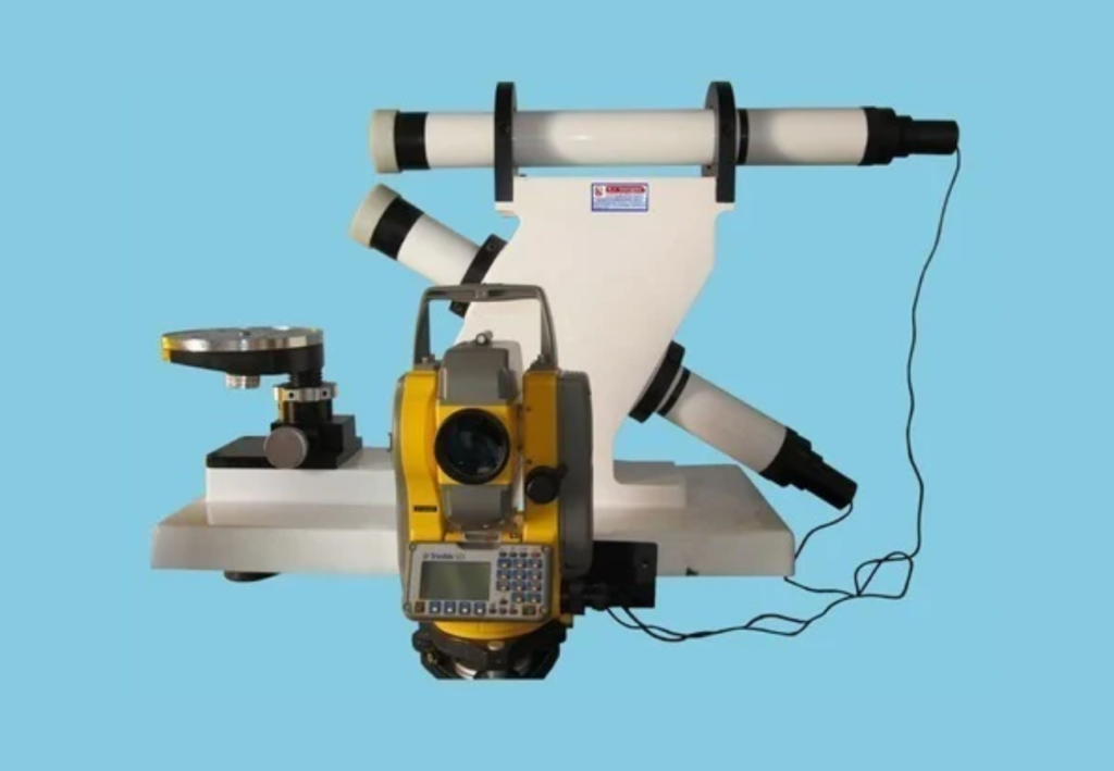
For centuries, Photogrammetry has played a critical role in understanding faraway objects and the Earth’s surface. Its uses have expanded over the years, leading to a powerful range of game-changing technologies in industries like construction, engineering, medicine, and much more. With that in mind, it’s essential to define what Photogrammetry entails, especially, in construction.
Construction is a dynamic and ever-evolving industry driven by technological advancements and innovative practices. Photogrammetry is one such innovation that has significantly impacted the construction sector. This is a technique that uses photographs to create accurate 3D models and measurements and has found numerous applications in the construction industry.
On that note, Photogrammetry In Construction is the science of using photography and digital imagery to measure distances between objects in surveying and mapping. Usually, surveyors gather measurements and data about an object by analyzing the change in position from two different images. They use things like perspective, advanced processing software, and photo analysis.
To get the job done, it can happen on the ground or in the air. Technically, it is capturing and stitching images together to create a digital model of the physical world. Thanks to “street views,” modern mapping tools — you can scope out a restaurant before deciding to go there, better navigate directions by viewing landmarks in the area, or simulate the experience of being on the road.
Understanding The Photogrammetry Measurement Processes
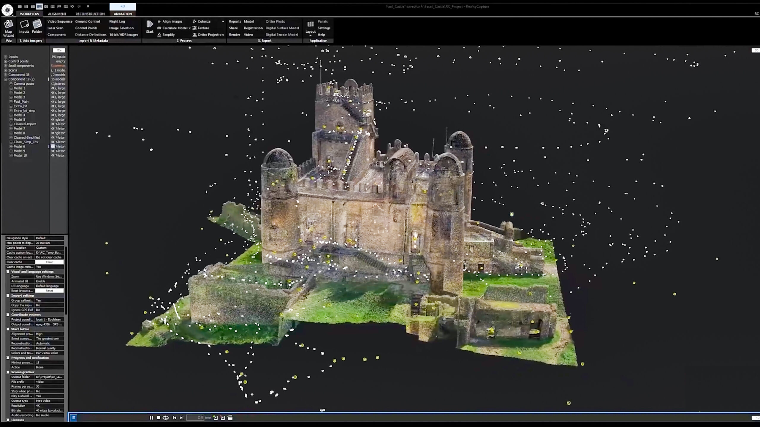
As mentioned, according to Medir Instruments Limited, Photogrammetry is the technique for creating these 3D views — the process of capturing images and stitching them together to create a physical virtual reality model of the world. It’s almost like a jigsaw puzzle, where pieces are collected and stacked together to create the bigger picture — each puzzle piece is an image formation.
In Photogrammetry, the more images that are captured and collected, the more realistic and detailed the 3D model will be. Therefore, Photogrammetry is a technique that can be used across industries, including architecture and archaeology. By capturing as many photos/images of an area or environment as possible, teams can build digital models of a site that they can view and analyze.
In this case, it’s worth noting that an early example of Photogrammetry was from 1849 — based on a French officer Aimé Laussedat. The officer used terrestrial photographs to create his first perspective architectural survey at the Hôtel des Invalides in Paris. 3D Scanning uses structured laser light to measure the locations of points in a scene, while Photogrammetry uses actual images.
As a result, the technique helps capture an object and turn it into a 3D model. This means good Photogrammetry requires a good dataset. It’s also important to take photos in the right pattern so that every area of a site, monument, or artifact is covered. Let your project site start delivering accurate data and stay on schedule without the possibility of delays and workflow disruptions.
The Essential Photogrammetry Types Plus Technique Methods
If we break down the word, we can see all of the parts that make up Photogrammetry in play. “Photo” refers to light, “gram” means drawing, and “-metry” refers to measurements. Photogrammetry uses photos to gather measurements with which we can create drawings and models. Those looking to stitch together a scene today take multiple pictures of a subject from varying angles.
And then, afterward, they can run them through a specialized application, which allows them to combine and extract the overlapping data to create a 3D model. The process of photogrammetry can vary, but the general idea revolves around gathering information about an object from photos of it. The photos from different locations and angles allow for precise calculations.
As a result, this process can also help surveying and mapping analysts gather the data they’re looking for. Typically, they use things like photo interpretation and geometric relationships to gather measurements. Reality data capture is a synonymous term with the transformation of data collection and analysis from the physical world — has made significant strides over the past few decades.
When dealing with earthmoving or excavation projects, utilizing Volumetrics Measurement Techniques to accurately calculate volumes is crucial. Fortunately, since Photogrammetry can measure stockpile volumes, excavation quantities, and landfills, this not only simplifies the process but also reduces the margin for error compared to traditional methods. On that note, various types exist.
Including the following:
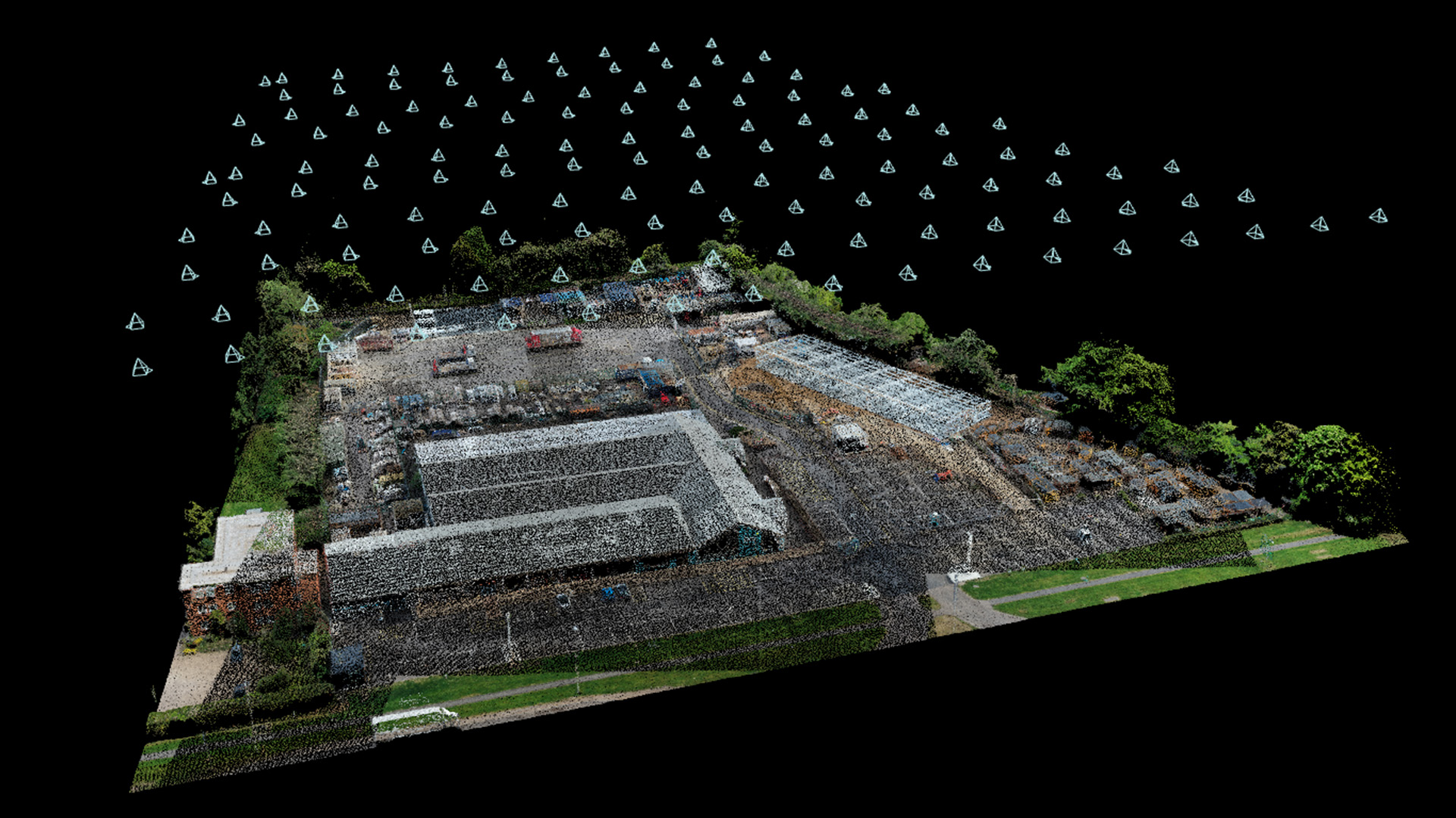
- Aerial Photogrammetry: It stations the camera in the air to take photos from above. This is generally used on larger sites or in areas that are difficult to access. Aerial photogrammetry is one of the most widely used methods for creating geographic databases in forestry and natural resource management.
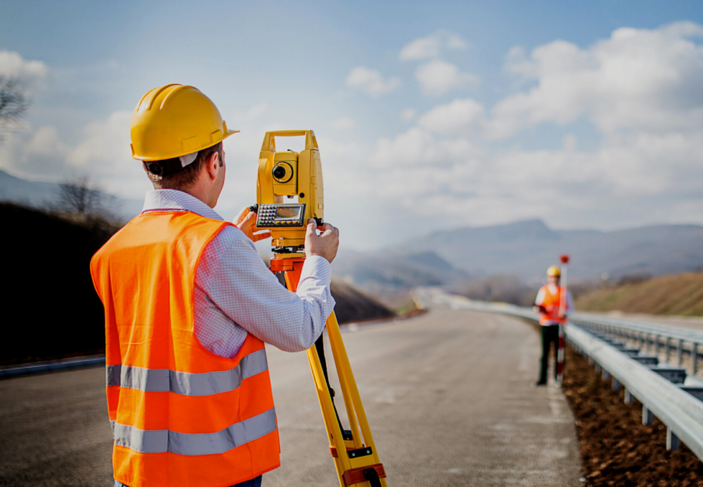
- Terrestrial Photogrammetry: Also known as close-range photogrammetry, it is more object-focused and usually relies on images taken by a camera that’s handheld or on a tripod. It enables speedy onsite data collection and more detailed image captures.
For your information, with the data gathered from Photogrammetry, we can create maps and 3D models of real-world scenes. The technology has been around for a long time and has been an important part of a variety of research in the last century. Its principles date back to Leonardo da Vinci’s research on perspective in 1480 — and many theories say it goes back even further.
After the invention of flight and World War II, Photogrammetric Technology (creating 3D models of physical objects and environments from 2D images) increased, with powerful camera designs and new aircraft built specifically for aerial photography and better camera positioning. These new inventions even put photogrammetry on the moon to map its surface (the Apollo missions).
Utilizing Aerial And Terrestrial Photogrammetry For Surveying
Taking aerial photos is one of the most common approaches to mapping out an area. In this process, a camera is mounted on an aircraft and pointed toward the ground with a vertical or near-vertical axis. As the plane follows its flight path, the camera takes multiple overlapping photos, which are then processed in something called a stereo plotter. So, what is the Stereoplotter)
The Stereoplotter Instrument helps determine elevations by comparing two different photos and conducting the necessary calculations. With the help of photogrammetry software, we can process this data and create digital models out of it. Regarding Terrestrial Photogrammetry, the images are taken from a fixed position on the ground with a camera’s axis parallel to the Earth.
Data about the camera’s position, such as its coordinates, are collected at the time the photo is taken. The instruments used for terrestrial photography are often theodolites, though regular cameras are sometimes used as well. Terrestrial Photogrammetry typically requires fewer resources and skilled technicians to accomplish, but it may take longer to cover a large land portion.
Moving out to a larger scale, space-based photogrammetry occurs with cameras either fixed on Earth, in an artificial satellite, or positioned on the moon or another planet. Photogrammetry was touted as a key part of space exploration even in the ’60s, and technological advancements have made it even more relevant. It can tell us about cloud patterns and create accurate earth maps.
In addition, the Photogrammetry measurement process also helps gather data about faraway planets. Typically, since Aerial Photogrammetry is one of the most common methods, thus, regarding how those photos get classified, aerial photos will fall under one of two categories.
Category Types:
- Vertical Photographs: These images occur when the camera axis is vertical. So, if you put the camera in an airplane, its lens would point down to the ground for a birds-eye view.
- Tilted Photographs: Though the axis may be nearly vertical, tilts in the aircraft can cause an image to be unintentionally tilted in one direction. Within the category of tilted photographs, we have oblique photos, in which you can see the horizon line, and low-oblique photos, in which there is no apparent horizon. The classification depends on the level of tilt of the camera off of its vertical axis.
The camera lens can offer a range of coverage. For instance, an ultra-wide-angle lens captures a larger field of view than a normal-angle lens. It would gather more of an image in its sights but could create distortion at its edges, depending on the camera lens and design.
Technically, when collecting aerial photos, operators capture many images in succession. Some of these images need to overlap with each other, so the image processing software can identify the changes and understand where specific objects are placed. When it can capture those common items, it can more effectively stitch the photos together or gather data about their positions.
Triangulation Mapping Characteristics Using Photogrammetric Models
The mapping process can get complex, but it all comes down to the concept of triangulation. Triangulation involves taking pictures from a minimum of two different locations. These pictures create lines of sight that lead from each camera to specific points on the object being photographed. The lines’ intersection (mathematically) helps produce 3D coordinates of the specified points.
Notably, triangulation is used in various fields such as agriculture and military intelligence. However, it is commonly associated with land surveying. Surveyors use surveying instruments such as Ruide Theodolite and triangulation to gather the location of a point with the help of angle measurements. Triangulation networks can also help with a surveying system by maximizing accuracy.
It’s similar to the way our eyes work and create depth. Depth perception occurs when we see an object from slightly different angles, those angles coming from each of our eyes. Our brains process the two images and make them into a single image that we can comprehend (stereopsis). This whole process is similar to triangulation and there are many other key applications in construction.
One such use case is construction progress monitoring — it’s simplified through the use of Photogrammetry measurement model. It enables project managers to track construction progress, identify delays, and optimize resource allocation. Regularly updated 3D Models generated from photographs provide a visual representation of the project’s evolution. Below are other user models.
User Model #1: Surveying And Mapping Site Projects
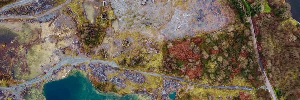
Photogrammetry is widely used for site surveys and mapping in construction. By capturing a series of aerial or ground-level photographs, it is possible to create detailed maps of construction sites. These maps help understand the terrain, identify potential challenges, and plan construction activities efficiently. Aerial photogrammetry, in particular, has become a game-changer for large construction projects, enabling quick and cost-effective surveying of extensive areas.
User Model #2: Documenting Construction Site Projects

Construction projects involve a series of iterations, changes, and modifications. Photogrammetry can be used to create accurate as-built documentation. By capturing photographs at different stages of construction, project managers can compare the as-built conditions with the initial design, ensuring that the project is progressing as planned and that deviations are addressed promptly.
User Model #3: Showing Building Information Modeling
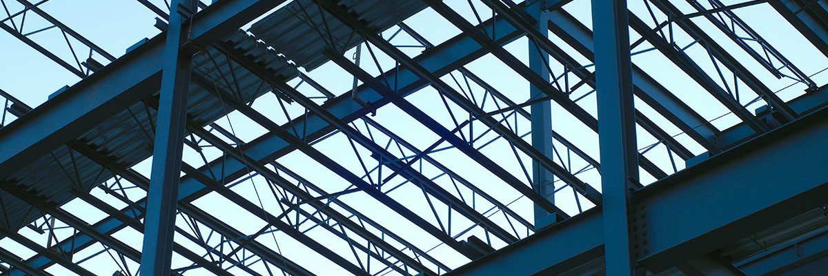
Building Information Modeling (BIM) is a crucial aspect of modern construction. It involves creating digital representations of building components and their interactions. Photogrammetry can assist in populating BIM models with accurate data by capturing detailed images of structural elements, plumbing, electrical systems, and more. This contributes to better project coordination and helps stakeholders make informed decisions.
User Model 4: Controlling Quality And Inspecting Projects
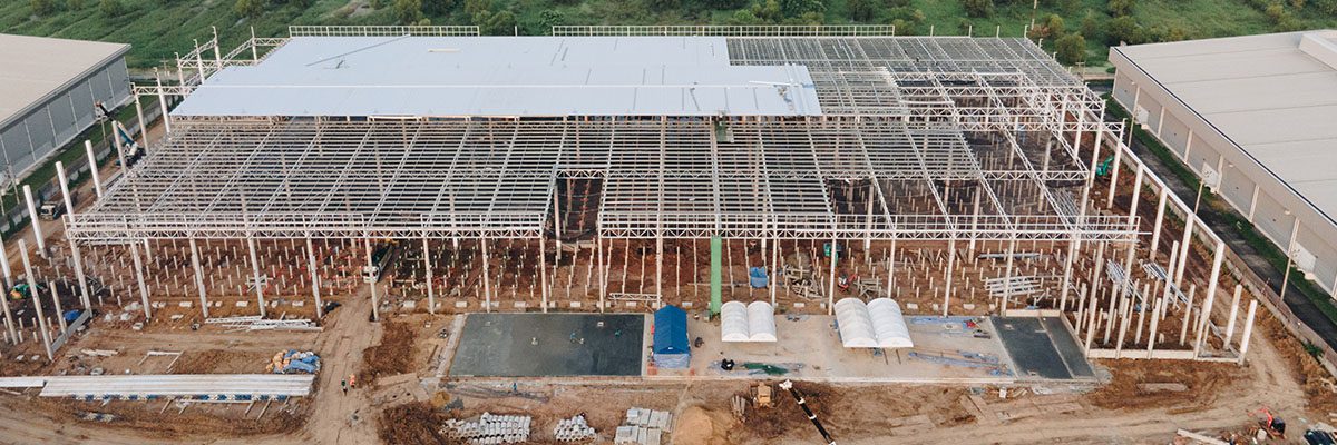
Ensuring the quality and safety of construction projects is a top priority. Photogrammetry aids inspection by providing precise measurements and visuals for identifying defects, discrepancies, and potential hazards. It allows for efficient and systematic quality control, reducing the need for costly rework.
User Model #5: Measuring Volumetrics And Calculating Volumes
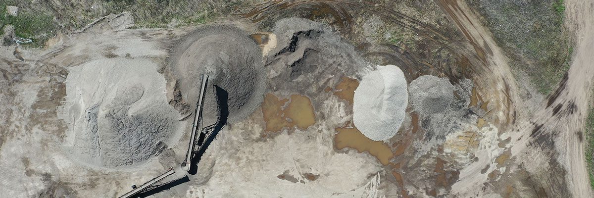
Notwithstanding, when dealing with earthmoving or excavation projects, accurately calculating volumes is crucial. Photogrammetry can measure stockpile volumes, excavation quantities, and landfills. This not only simplifies the process but also reduces the margin for error compared to traditional methods.
Why Photogrammetry Is A Cornerstone In The Construction Industry
By all means, Medir Instruments Limited has provided clients with cutting-edge geospatial data and imagery products. Over the years, we’ve helped clients identify the data sets they need to solve problems, monitor conditions, and meet project requirements — no matter their industry or field. We have got expert photogrammetrists, programmers, and imagery scientists to achieve it.
On the one hand, Photogrammetry has revolutionized the construction industry, offering many applications and significant benefits. This technology enhances efficiency, accuracy, and safety in construction projects, from site surveys and mapping to quality control and progress monitoring. On the other hand, as technology continues to advance, its role in construction is expected to grow.
One of its topmost, crucial, and fundamental roles is to help shape the future of the industry in an increasingly digital and data-driven world. Be that as it may, it’s safe to say that Photogrammetry is not just a tool for today but a cornerstone for the future of the construction industry. Realistically, one of it’s main benefits is that Photogrammetry is more cost-effective than other methods.
In this case, it’s worth mentioning that Photogrammetry is a cost-effective alternative to traditional surveying methods, as it reduces the need for on-site personnel and expensive equipment. Given the rapidly changing world for superior geospatial data, Aerial Photogrammetry, in particular, provides a broad overview of large areas in a relatively short period, saving time and money.
Other Photogrammetry Benefits:
- Delivers accuracy and precision: Photogrammetry offers a high level of accuracy and precision, resulting in reliable data for decision-making. Measurements and 3D models created through this method are often more precise than those obtained through manual surveying.
- Helps foster increased safety: By minimizing the need for workers to be on-site for surveying, photogrammetry contributes to improved construction site safety. It reduces the potential risks associated with manual measurements and data collection.
- Efficient project documentation: Creating detailed and comprehensive documentation is crucial in construction. Photogrammetry streamlines the documentation process, ensuring that project records are up-to-date and accurate. This documentation is valuable in disputes, warranty claims, or future modifications.
- Project management improvement: Photogrammetry aids project managers in making informed decisions by providing real-time data on construction progress and site conditions. This, in turn, leads to better project coordination and cost control.
- A redux of environmental impacts: Reducing the need for extensive on-site surveying and measurement processes can positively impact the environment. Fewer site visits and reduced fuel consumption contribute to a smaller carbon footprint.
In other words, it helps create accurate fully textured 3D models from photographs and can be used to capture a range of subjects from the smallest objects to entire landscapes. From this data, we can create 3D model prints, videos, and orthoimages (scaled images with no distortion or perspective), which allow for more accurate and complete interpretative site drawings than ever before.
Accelerating 3D Photogrammetry On A Powerful RTX Workstation
For the most accurate photogrammetry process results, teams need a massive, high-fidelity dataset. By all means, more photos will result in greater accuracy and precision. However, large datasets can take longer to process, and teams need more computational power to handle the files. Fortunately, the latest advancements in GPUs help teams address this.
Using advanced GPUs such as the NVIDIA RTX Card can allow target product users to speed up processing and maintain higher-fidelity models, all while inputting larger datasets. For example, construction teams often rely on photogrammetry techniques to show progress on construction sites. Some companies capture images of a site to create a virtual walkthrough.
Unfortunately, an underpowered system can result in a choppy visual experience — this is often a technicality that detracts from a working session with clients or project teams. Fortunately, with the RTX Pro GPUs under large memory, architects, engineers, and designers can easily manage massive datasets to create and handle photogrammetry models faster.
At the same time, Photogrammetry is an analogy that uses GPU power to assist in the vectorization of the photo — this usually accelerates stitching thousands of images together. Eventually, this means that with the real-time rendering and AI capabilities of RTX professional GPUs, teams can accelerate 3D workflows, create photorealistic renderings, and keep 3D models up to date.
Exploring The Innovative Photogrammetry Journey Into The Future
Remember, the idea of Photogrammetry dates to the late 1400s, nearly four centuries before the invention of photography. Uniquely, Leonardo da Vinci developed the Perspective And Projective Geometry Principles, which are foundational pillars of photogrammetry. Geometric perspective is a method that enables illustrating a 3D object in a 2D field by creating points that showcase depth.
On top of this foundation, aspects such as geometry, shading, and lighting are the building blocks of realistic renderings. Photogrammetry advancements now allow users to achieve new levels of immersiveness in 3D visualizations. The technique has also paved the way for other groundbreaking tools like reality-capture technology which helps collect data on real-world conditions.
As a result, it helps give users reliable, accurate information about physical objects and environments. NVIDIA Research is also developing Artifical Intelligence (AI) techniques that rapidly generate 3D scenes from a small set of images. For example, Instant NeRF and Neuralangelo use neural networks to render complete 3D scenes from just a few dozen still photos or 2D video clips.
Instant NeRF could be a powerful tool to help preserve and share cultural artifacts through online libraries, museums, virtual-reality experiences, and heritage-conservation projects. Professional artists are already creating beautiful art scenes from different perspectives. Archaeologists can use NVIDIA RTX to expand skills, create and render high-quality models of artifacts and sites.
In Summary;
It’s worth mentioning that Photogrammetry is a crucial element in the construction industry. Its applications are expanding across industries and becoming increasingly accessible. Eventually, objects, locations, and even industrial digital twins can be rendered volumetrically — in real time — to be shared and preserved, thanks to advances in photogrammetric technology.
Museums can provide tours of items or sites they otherwise wouldn’t have had room to display. Buyers can use augmented-reality experiences to see how a product might fit in a space before purchasing it. And sports fans can choose seats with the best view. As mentioned, it’s clear that Photogrammetry is a modern innovation that has significantly impacted the construction sector.
Related Resource: Best Photogrammetry Software: The Topmost 13 Recommended Tools
Medir Instruments Limited is a topmost trusted partner in Photogrammetry matters — it provides technology solutions for aerial data results acquisition. Equally important, it is worth noting that Medir Instruments Limited is a state-licensed professional engineering consulting agency and land surveying firm — its employees are state-licensed professional engineers and land surveyors.
To help deliver credible Photogrammetry results to the target clients and potential customers, the Medir Instruments Limited Team of certified and qualified experts may often use photographs to create accurate 3D models and measurements. They help analyze the geometry and spatial properties of images to extract data and create accurate representations of objects and environments.

