Underground Surveying
An Underground Surveying process is integral to the realm of construction and urban planning. It involves the detailed examination of the subsurface to identify types and locations of utilities and structures.
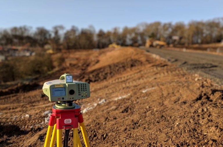
Usually, the underground surveyors from Medir Instruments Limited help set out underground workings according to mine designs. They often conduct CMS scans and maintain accurate survey control points. Likewise, they maintain and update the digital survey database and mine plans. In most cases, they may operate total stations, laser scanners, GPS, and related equipment.
What Our Underground Surveying Entails
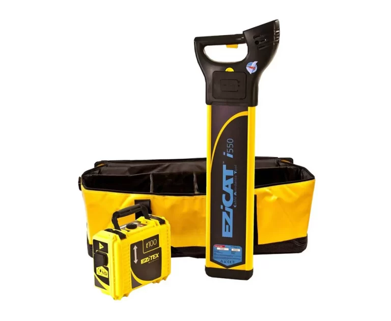
Our specialist Underground Utilities team harnesses the latest survey technology, including dual-frequency ground penetrating radar (GPR), to locate and trace services below ground, including sewers, gas mains, heating and water, lighting cables, BT telephone lines, other communication cables, and traffic signalling cables.
In addition to locating utilities, our underground surveys provide detailed data on below-ground conditions ahead of any site excavations, drilling, piling, or borehole clearance. Using GPR and electromagnetic equipment, we can identify and position underground features such as voids, steelwork, shafts, and graves, which could impact future construction activity.
Where remote visual inspections are required, we carry out CCTV surveys with robotic cameras providing high definition visual imagery inside drains, pipes, voids, and areas of restricted access. Our surveyors can view the camera images in real-time using specialist on-site software and then provide full digital imagery, supported by a detailed technical report.
Any cracks, root ingress, damage, and blockage identified in a drainage survey can be cleared with our high-pressure jetting service. A recent addition to our range of underground surveys is concrete and rebar scanning, where our team uses GPR technology to locate and confirm the layout of structural reinforcement within a building or structure, with data presented as high-resolution 3D imagery. Be that as it may, below are some of our featured Underground Surveying service solutions.
1. Geophysical Survey
A geophysical survey can provide valuable data for a variety of projects. Frequently used for road construction investigations, mapping post-tension cables, detecting voids and sinkholes, exploring mine workings, and determining the depth to bedrock.
Our detection methods can identify foundations, buried obstructions, underground storage tanks (USTs), fuel tanks, cellars, air raid shelters, piles, and tie rods. When combined with reinforcement bar (rebar) mapping, High-frequency Concrete analysis, and Bridge Deck analysis, a geophysical survey can enhance your project’s planning and execution.
By identifying and addressing hidden health and safety hazards during the design and planning phases of your project, we can significantly reduce the risk of incurring remediation costs later in the construction process. Understanding the site’s constraints early can lead to substantial savings if potential hazards arise later in the construction timeline.
Our geophysical surveys align with our other services, which include ground penetrating radar surveys (GPR), topographical surveys, LiDAR, buried utilities detection, CCTV drainage condition assessments, and hydrographical (bathymetric) surveys. Always remember, our geophysical surveys use non-invasive, high-capacity data-capturing instruments. This method enables us to collect extensive data while minimising both the time spent on-site and disturbances to the surrounding environment.
2. Utilities Survey
The useful data you will receive from a utilities survey minimizes the need for any follow-on excavations. They’re also an excellent way to identify safe areas to carry out excavations, boreholes, and piling. Early identification of any buried services ensures projects can progress smoothly throughout the entire design and build phase and reduce the risk of unplanned delays.
Underground utilities mapping provides a clear understanding of buried services and any potential hazards to the development. Our PAS 128 utilities surveys locate all mains services, including electricity, sewers, gas and water mains, fibre optics, heating, lighting cables, communication networks, and traffic signalling cables.
We have teams across the nation covering projects in all construction sectors. Our experience, and the scope of PAS 128 survey types we can provide, will help you with the data you need across industrial brownfield sites earmarked for major residential development, through to verifying existing underground records.
How The Utilities Survey Benefits Your Project
We will identify, trace, and map of all major underground buried services, as a standalone utilities survey or as part of an integrated package that can include CCTV drainage, topographical, or measured building survey, depending on the project’s needs.
Your supplied results are PAS 128 specification compliant with additional statutory record services also available, and are overlaid onto a topographical survey before issuing in both CAD and PDF formats. Identifying and mitigating potential hazards and challenges at an early stage will allow your project to progress based on knowledge. We can plan the surveys to meet your timescales and offer potential cost savings and consistency in the final drawings and output.
3. CCTV Drainage Survey
Our dedicated teams are ready to perform a detailed CCTV drainage survey, providing you with an in-depth visual inspection and a comprehensive condition report, along with valuable survey data. Using innovative remote visual inspection (RVI) technology, our CCTV surveys for drains offer you high-definition imagery of subterranean conditions—whether underground, underwater, or within pipework, voids, and confined spaces.
Our thorough drain survey process includes the manual lifting of every inspection chamber or manhole cover, with our experts finding the chambers as needed. We accurately document the invert depth, measure the pipe diameter, check the lining of the drain, and assess the type of drainage system, including the construction of each chamber. All findings are then overlaid onto the topographical survey of your site, ensuring all risks are clearly shown and categorized.
Why Building Drains Need A CCTV Drainage Inspection
Our clients opt for a full-length CCTV drainage survey to mitigate potential issues as early in the project as possible, including leak detection underground. This includes the specific condition of each pipe and identifying any structural defects, root ingress, cracks, and blockages. Should our technical report highlight any significant issues, such as blockages, our team will conduct sewer maintenance with high-pressure jetting to the areas of concern to restore the entire drainage network to its fully functioning capacity.
Our Sewer Maintenance Process
We advise on sewer maintenance plans for a multitude of location types, helping identify and resolve drain unblocking in public buildings, educational facilities, country estates, and listed buildings. We also deal with outdoor spaces and areas of public footfall, including car parks. In the case of blocked drainage and sewer systems, our solutions for high-pressure jetting include de-scaling as well as fat and grease removal.
We can also use root-cutting equipment within the drainage network to cut back and clear any root ingress before jetting the system completely clear. Our ongoing drain maintenance programmes can be useful in locations known for localised or seasonal flooding to prevent sewer systems from overflowing. Where our CCTV drainage survey has identified blockages or root ingress, our team will advise on the best action for optimal Sewer maintenance, from high-pressure jetting or remediation measures.
Sewer Cleaning Vs. Drain Cleaning
Drains are connected to a building’s sink and toilets, which can become blocked through debris build-up or inappropriate use, such as nappies being flushed. Usually, there are multiple drains on site, and if these are slow-draining but functional, your blockage may actually be in the sewer system. Our team can identify the problem and bring a range of solutions that include high-pressure jetting, de-scaling, and fat and grease removal. For root ingress, we employ root-cutting equipment within the drainage network to cut back and clear before jetting the system completely clear.
4. GPR Concrete & Rebar Scanning
GPR Concrete and Rebar scanning is a key aspect of many sector projects, capable of detecting areas of voids within more unusual structures, including sea wall defences and promenades. Not only is this a more efficient surveying method, but the 800mm scan depth can directly provide you with high-resolution 3D imagery in real time.
A GPR survey enables you to mitigate the risk of striking the steelwork during construction, reducing the risks of injuries, damage to project equipment, or weakening of the existing concrete structure. On that note, we provide a GPR survey for a broad range of projects and sectors. Using the latest ground-penetrating radar technology, we locate and measure the layout of structural reinforcement within elements of a building structure, including floor slabs, RAAC planks, and concrete beams.
Ground Penetrating Radar Vs Traditional Method Approach
A traditional approach to concrete and rebar scanning often means drilling a core sample. This adds cost, time delays, potential damage, and risk to a project. Using Ground Penetrating Radar reduces the need for invasive techniques, with little or no disturbance to the building, its occupants, or customers. It also means that the survey can be carried out much more quickly, which benefits the project overall.
5. Underground & Site Investigations
An Underground survey is an essential part of any site investigation in building construction. It identifies safe areas ahead of any invasive works, with the results confirming evidence of previous site use to allow you to fully understand below-ground site conditions. Using the latest equipment, such as ground-penetrating radar (GPR) and electromagnetic equipment, the Medir Instruments Limited service solutions team can identify and position underground geological features and relics of previous site use.
The ground investigation process is beneficial for projects taking place on brownfield sites where there has been previous or extensive use. Details of the Underground Survey can identify various elements that include voids, basements, shafts, storage tanks, foundations, steelwork, reinforced mesh, graves, or even unexploded ordnance. Data from the Underground survey is marked up on site and incorporated into the wider survey project, where we can also capture the above-ground features with an in-depth topographical survey.
Other frequent requests for our services include Borehole soil investigations and trial pits, piling, and window sampling clearance surveys. Pinpointing specific locations for boreholes, we scan the ground beneath to ensure these will not impact on utilities or cause any below-ground obstructions.
6. Asset Tagging Systems
Of course, Asset Tagging Systems are a recent introduction to our underground surveying services. Allowing for permanent identification of underground assets, the tags are ideal for sites and areas where conventional signage cannot be used. Site owners can, at a glance, identify the purpose of an inspection chamber, whether that is for BT cabling, gas and water valve work, or foul and surface water sewers.
Asset tags provide a cost-effective and aesthetically pleasing alternative to traditional identification processes such as spray-painting drains, gullies, and manhole covers. Generally speaking, the Environment Agency states that the management of drainage systems should be one of the top ten environmental priorities for all sites. Their guidance, together with EPR permits and Environmental Management Systems, requires sewers to be clearly marked or labelled.
The benefits of implementing asset tagging systems:
- Durable design for use in high-traffic areas due to its UV and abrasion-resistant coating.
- Preventing pollution at commercial and industrial sites by ensuring the correct drainage connections are used.
- Provides a fast and effective disaster recovery response in the event of a site spillage, preventing the pollution of surface water and sewers.
- By preventing cable strikes, the markers will help protect employees, contractors, and the wider business.
- Help comply with the CDM Regulations.
We’re the leading engineering surveyors in Kenya and in the East Africa region, offering a full in-house service. We provide you with accurate, detailed report data, allowing you to make informed choices. Typically, we can easily and quickly conduct the CCTV drainage survey in conjunction with underground utility surveys and topographical assessments, or we can use existing site surveys for your convenience.
To find out more, please complete the Contact Us Form to get in touch with one of our specialist surveyors. Available across our network of offices, our teams of surveyors share many years of experience and are in an ideal position to discuss your project in more detail and offer the best survey solution from our broad range of complementary services.