Category Services

Measured Building Surveying (MBS)

What Is Measured Building Surveying (MBS) Method?

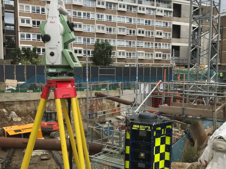
A Measured Building Surveying (MBS) process is a highly accurate, detailed assessment of a building's dimensions, structure, and features, creating precise 2D plans (floor plans, elevations, sections) or 3D models (BIM) using advanced tech like laser scanners, drones, and total stations.

Monitoring Surveying

What Is Monitoring Surveying?

A strategic monitoring surveying process provides essential data to a construction project by identifying movement or deformation in a building or structure, as well as any environmental impacts such as noise, dust, and vibration.

Site Engineering

What Is Site Engineering?

Site Engineering is the technical discipline within civil construction that bridges design plans and physical reality, involving surveying, setting out (marking locations), supervising construction, ensuring quality/safety, managing technical aspects, and solving on-site infrastructure building problems.

Hydrographic Surveying

What Is Hydrographic Surveying?

Hydrographic Surveying is a methodological process that is often used to calculate the depth of the water body and measure the ground below the water. This data is translated into a Digital Terrain Model (DTM), detailing the contours of the land below the water.

Drone Surveying

What Is Drone Surveying?

Drone Surveying uses Unmanned Aerial Vehicles (UAVs) with sensors, cameras, and GPS to capture high-resolution imagery and spatial data, creating precise 2D maps, 3D models, and digital terrain models (DTMs) efficiently and safely.

Land Surveying

What Is Land Surveying?

Land Surveying is the science and profession of determining the location of points, distances, and angles on the Earth's surface to establish property lines, create maps, and guide construction and development projects.

The Automatic Aerial Triangulation Survey Fundamentals

What Is Automatic Aerial Triangulation?

Automatic Aerial Triangulation is a photogrammetric process that uses overlapping aerial photographs to determine the X, Y, and Z ground coordinates of points, crucial for creating accurate maps and 3D models. The primary goal of Automatic Aerial Triangulation is to establish a precise spatial framework for a set of aerial images, enabling the creation of accurate maps, digital elevation models (DEMs), and other photogrammetric products.