Drone Surveying
Drone Surveying uses Unmanned Aerial Vehicles (UAVs) with sensors, cameras, and GPS to capture high-resolution imagery and spatial data, creating precise 2D maps, 3D models, and digital terrain models (DTMs) efficiently and safely.
Drone Surveying uses Unmanned Aerial Vehicles (UAVs) with sensors, cameras, and GPS to capture high-resolution imagery and spatial data, creating precise 2D maps, 3D models, and digital terrain models (DTMs) efficiently and safely.
An Underground Surveying process is integral to the realm of construction and urban planning. It involves the detailed examination of the subsurface to identify types and locations of utilities and structures.
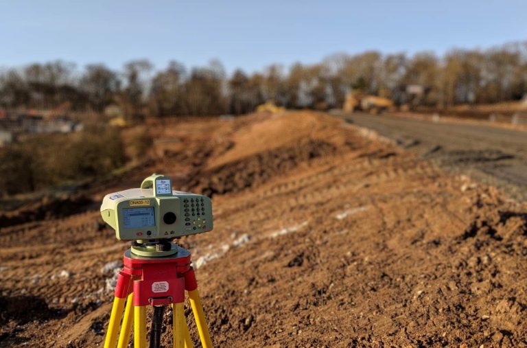
Land Surveying is the science and profession of determining the location of points, distances, and angles on the Earth’s surface to establish property lines, create maps, and guide construction and development projects.
Automatic Aerial Triangulation is a photogrammetric process that uses overlapping aerial photographs to determine the X, Y, and Z ground coordinates of points, crucial for creating accurate maps and 3D models. The primary goal of Automatic Aerial Triangulation is to establish a precise spatial framework for a set of aerial images, enabling the creation of accurate maps, digital elevation models (DEMs), and other photogrammetric products.

Given the ever-evolving digital online marketplace, it’s worth mentioning that Cloud Computing Technology is an on-demand service that has obtained mass appeal in corporate data centers and hosting environments. The cloud enables the data center to operate like the Internet, and computing resources can be accessed and shared as virtual resources in a secure and scalable manner. Like most…

As a rule of thumb, IT Risk Management is crucial to any organization’s operations. It involves identifying, assessing, and managing risks affecting an organization’s information systems and processes. It’s worth mentioning that most IT-related risks can come in various forms, including cyber-attacks, hardware or software failure, data breaches, and natural disasters. In today’s evolving threat-based…

Due Diligence (DD) stands as a crucial process in the world of corporate business transactions. It is an investigation, audit, or review process to confirm facts or details of a matter under consideration. In other words, it systematically analyzes and mitigates risk from a business or investment decision. Sometimes, in the world of financial transactions…

According to the Medir Instruments Limited team of professional engineers and certified land/mapping surveyors, Precision Instrument Calibration is one of the primary processes used to maintain instrument accuracy. So, in other words, Calibration is the process of configuring an instrument to provide a result for a sample within an acceptable range. In fact, eliminating or minimizing factors…

According to the Medir Instruments Limited team of professional engineers and certified land/mapping surveyors, Precision Instrument Calibration is one of the primary processes used to maintain instrument accuracy. So, in other words, Calibration is the process of configuring an instrument to provide a result for a sample within an acceptable range. In fact, eliminating or minimizing factors…

To enumerate, Medir Instruments Limited is a locally incorporated, wholly owned, and managed by indigenous Kenyans. The firm engages in sales of surveying and engineering equipment and accessories, servicing of such equipment, hiring of survey equipment, processing of survey works, navigation systems solutions, tracking systems, and the like. As well as survey instruments training, and…